Cassiar Highway (British Columbia)

During June, July, and August of 2006, Linda and Mike journeyed North of the border and spent more than two months enjoying the beauty of western Alberta and just about all of British Columbia. We passed through some spectacular scenery and were amazed at the amount of wildlife that seemed to be there just for us—up close and personal.
Along the way, people were always telling us great places to go and see, but several also discouraged us from returning South via the Cassiar highway. However, we chose to ignore the disparaging comments and decided to see for ourselves what lay ahead.
We were pleasantly surprised by the beauty, serenity, and lack of the hordes of tourists, as we slowly journeyed back toward the US border. Having no schedule and really no itinerary, we were able to take some wonderful side trips and see some wonderous sights—and, of course, took lots of pictures along the way.
When we returned to the "lower 48," we decided to share our views of the Cassiar hwy, and to let other RVers know that the journey is well worth their time and effort.
Below is the RV America post that we made, telling others of our satisfaction and enjoyment. We hope that, you, too, will someday have the time and inclination to explore the beauty of British Columbia.
Please donít let the nay-sayers dissuade you from driving the Cassiar Hwy between Watson Lake, YT and Kitwanga, BC.
I was surprised at the number of people who tried to discourage me and my lady from driving down the Cassiar hwy—too slow, too rough, too rocky, etc. etc.
Well, having ignored their advice, we are totally in awe at the stupendous scenery, beauty, and wildlife that we saw on our journey South. Yes, the scenery is better in the southbound direction than the Northóbut still great either way. We found some lovely little RV parks (and several even had WIFI).
The first 90 miles or so South of Watson Lake is not great. The road is rough, bumpy, potholed, and curvy—but quite navigable even in larger motorhomes dragging toads. We just drove slowly along at about 25 mph or so, until we got out of the rough stuff. Not really a big deal—if you have even a little bit of patience.
Once past the rough stuff, the road was nicely paved all the way (except for two stretches of about 12 miles each that was hard-pack—not rough gravel that cracks windshields). If dry, the hard-pack was a little dusty, and if wet, was a tad slippery, but nowhere did we have any problems.
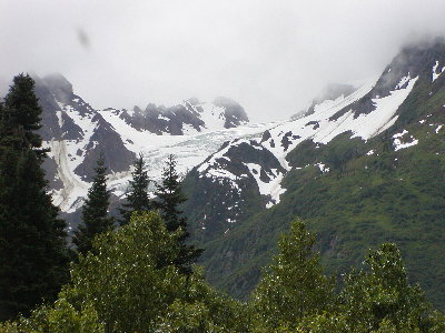
The traffic was almost non-existent, and we just let the occasional car, truck or RV pass us, and then we had the road to ourselves again—able to stop just about whenever to capture great pics of wildlife or mountain vistas.
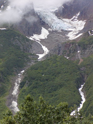
By all means, take the time to drive out to Stewart, BC/Hyder, AK and take in the scenery out West. The side trip is well worth an extra day—and you will even find WIFI at the RV park in Stewart; (it was being setup just as we left).
The farther South you get, the better the road gets, with many parts newly paved and even striped down the center and the shoulders. Donít rely on the Milepost or the RV Campground directories to find a place to stay—there are many nice little mom & pop RV parks that are more than happy to have you as a guest. However, some only have 15A electric service, but we didnít needed the ACs very much at all.
Another surprise to us was that the gas prices seemed to be less than along the Alaska hwy, (but still rather steep compared to US prices. The best price we saw was 96.9¢/ltr and the worst was 134.9¢/ltróbut the most we paid was 120.9¢/ltr.
Bottom line is that the drive was well worth our time, exceeded our expectations, and we would do it again with no hesitation (or reservations).
Just wanted to share our experience and encourage others to try that route on their way back down to the lower 48.

